

USAtlas Geology app for iPhone and iPad
Developer: Geobyte Europe S.L
First release : 17 Sep 2014
App size: 1.18 Gb
US GEOLOGY is one of the twelve chapters of The National Atlas of the United States® which was coordinated and lead by USGS, this is the effort of more than 20 Federal agencies. The other layers are, Agriculture, Biology, Boundaries, Climate, Environment, Government, History, Map Reference, People, Transportation and Water. Geobyte is planning to produce these Chapters in future.
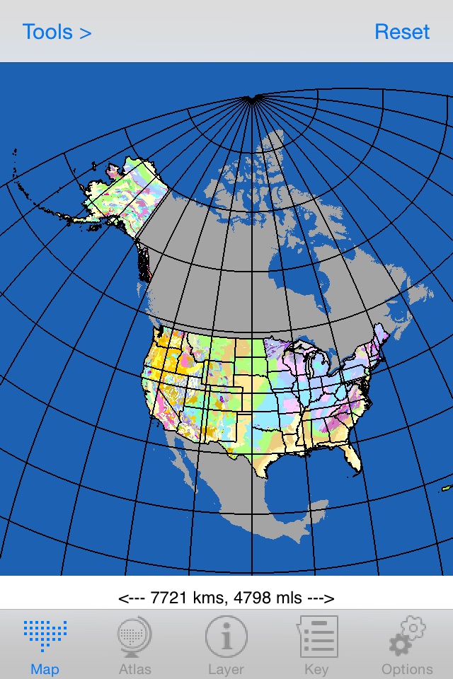
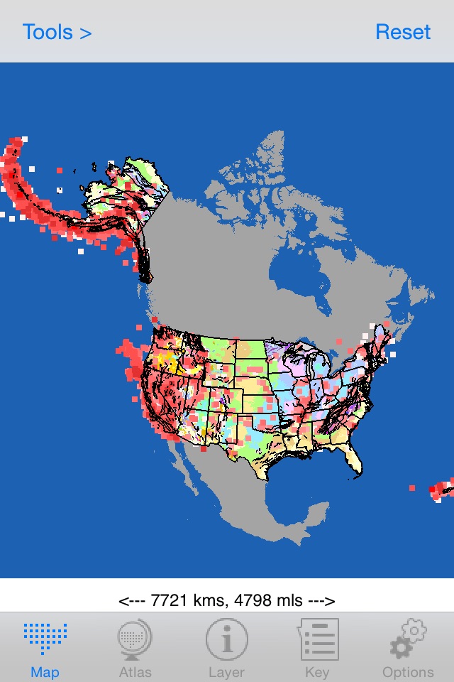
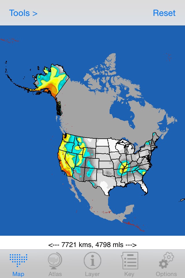
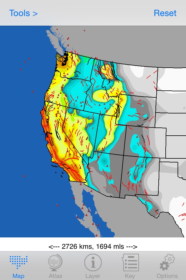
In this volume we have incorporated 46 layers of vector information available at The National Atlas of the United States® Website. These include Earthquakes, Volcanoes, Geologic Map, Mineral Operation, Magnetic Field, Waterways, County Boundaries and many more.
Detailed Geologic Maps (scale of 1:500,000 or larger) and Faults, from Open-File Reports of USGS of 48 States are also included.
The Legend or Key for each layer has been designed in the way that one can select all or select specific units from the legend and generate the map of particular interest. For example you can generate map with only Cretaceous Sedimentary rocks and only earthquakes of certain magnitude.
The units on the map can be identified by long tap on the map.
With the GPS capability of the system the location on the ground is known and you can add, edit and save notes on the map.The distance between two points and the area of polygon can also be calculated.
All the layers can be displayed in both Mercator and Lambert Equal-Area Projections.
There is no need to have access to WIFI, 3G or 4G Data Network to use this app. All the data are saved in your device.
The National Atlas of the United States®, is the registered trademark of the United States Department of the Interior
The layers included are:
Coal Fields
Continental Divide
Earthquake
Elevation Contours
Geologic Map
Geologic Map – Calderas
Geologic Map – Faults
Geologic Map – Impact Sites
Geologic Map – Metamorphic Areas
Geologic Map – 1:500 k State by State
Geologic Map – Faults 1:500 k
Glacial Limits
Karst – Engineering Aspects
Karst – Subsidence
Landslide – Incidence and Susceptibility
Landslide – Costly Events
Landslide – Costly Regional Events
Magnetic Field - Declination, 1 degree increments
Magnetic Field - Declination Secular Variation, arc mins/yr
Magnetic Field – Horizontal Intensity, 500 nanoTesla increments
Magnetic Field – Horizontal Intensity Secular Variation, nano Tesla/yr
Magnetic Filed – Inclination, 1 degree increments
Magnetic Field – Inclination Secular Variation, arc mins/yr
Magnetic Field – Total Field Intensity, 500 nanoTesla Increments
Magnetic Field – Total Field Intensity Secular variation, nano Tesla/yr
Magnetic Field – Vertical Intensity, 500 nanoTesla Increments
Magnetic Field – Vertical Intensity Secular Variation, nanoTesla/yr
Mineral Operations – Agricultural Minerals
Mineral Operations – Construction Minerals
Mineral Operations – Ferrous Mines
Mineral Operations – Ferrous Processing Plants
Mineral Operations – Miscellaneous Industrial Operations
Mineral Operations – Nonferrous Mines
Mineral Operations – Nonferrous Processing Plants
Mineral Operations – Refractory, Abrasive and Other Industrial Operations
Mineral Operation – Sand and Gravel Operations
Mineral Operations – Stone, Crushed
Quaternary Faults
Seismic Hazard – Peak Acceleration
Surficial Deposits (Eastern & Central States)
Volcanoes
Waterways
State Boundaries
County Boundaries
Railroads
Main Roads (inc Ferries)
Latitude and Longitude
…………………………..